HURRICANE IKE
SEPTEMBER 13, 2008
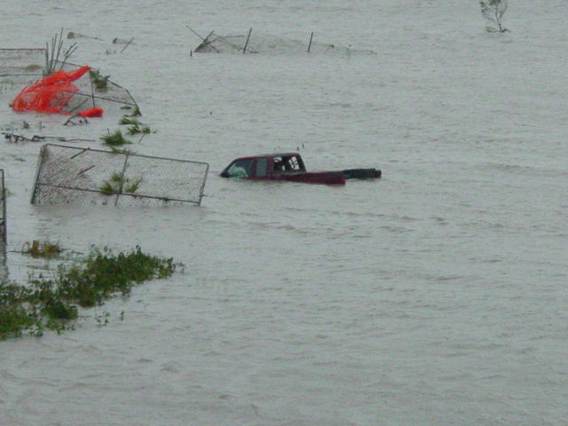
Hurricane Ike was the third most destructive storm to ever hit the United States. It came into Galveston Island as a Category 2 storm with winds of 110MPH hurricane extending 275Â miles and 120Â miles, respectively, from the center., though due to the size of Ike, the storm surge was the devastating part.
The National Weather Service in Houston/Galveston, TX issued a strongly worded bulletin, regarding the storm surge along the shoreline of Galveston Bay. The bulletin advised residents living in single-family homes in some parts of coastal Texas may face "certain death" if they do not heed orders to evacuate. Reports said as many as 40 percent of Galveston's citizens may have not paid attention to the warnings. People in low-lying areas who had not heeded evacuation orders, in single-family one- or two-story homes, the warnings turned out to be true for some who refused to evacuate.
Even though there were advance evacuation plans, Mary Jo Naschke, spokesperson for the city of Galveston, estimated that (as of Friday morning) a quarter of the city's residents paid no attention to calls for them to evacuate, despite predictions that most of Galveston Island would suffer heavy flooding. By 6 p.m. Friday night, estimates varied as to how many of the 58,000 residents remained, but the figures of remaining residents were in the thousands. Widespread flooding included downtown Galveston: six feet deep inside the Galveston County Courthouse, and the University of Texas Medical Branch at Galveston was flooded.
Despite the warning from the national Weather Service and numerous news stations, residents just did not listen as they felt that the storm surge would never happen. Even though the flooding was already happening two days out from the storm in neighborhoods. As a result from not paying attention to the storm surge reports or simply just not believing in them, so many residents lost their family pictures, mementos, keeps sakes, heirlooms and other important belongings one would cherish, items that are just not replaceable. Items they simply could have taken with them to save.
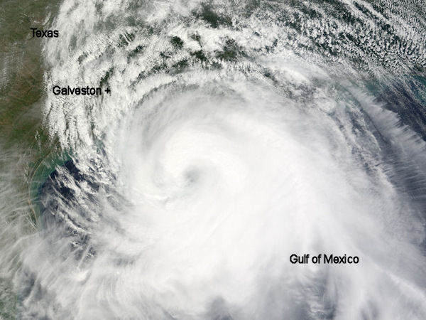
Just by watching the satellite images of the size of the storm should have been enough
warning to many residents to pack up their personal belongings to save them. The storm
swallowed the Gulf of Mexico and was as big as Texas.
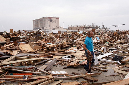
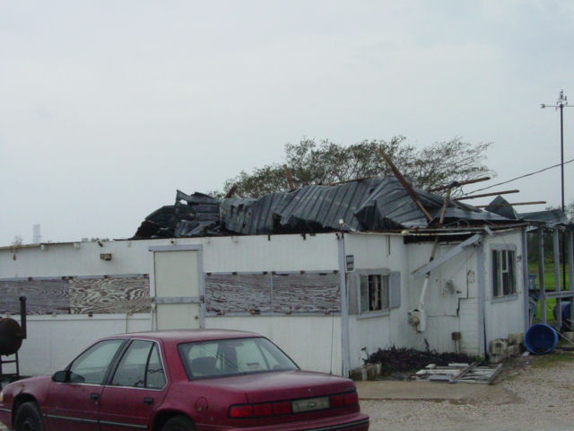
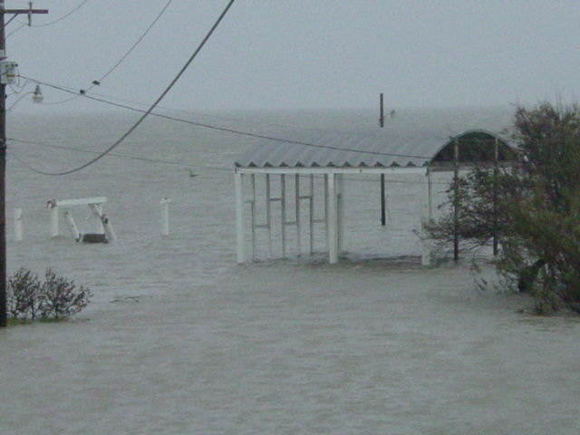
By daylight on September 13, Ike had moved through and little remained of it. Though the destruction it left behind in the coastal City's was devastating. Galveston was not the hardest hit, that belongs to Gilchrist, Port Bolivar, Crystal Beach all located on Bolivar Peninsula. Though Galveston will get the majority of the news coverage.
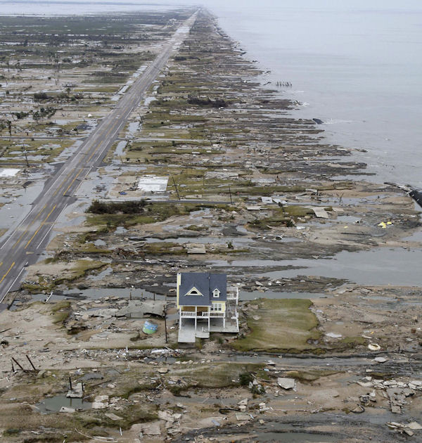
Gilchrist, Texas located on the Bolivar Peninsula was wiped clean by the tidal surge.
This LINK shows the devastation that Crystal Beach took. It has some excellent photos with before and after pictures.
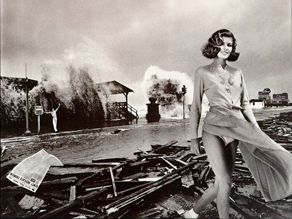
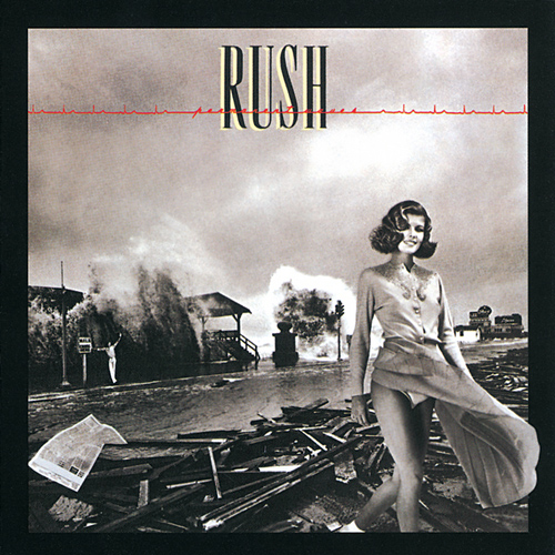
Located on the Seawall in Galveston are two granite markers. One of these markers is featured on a 1980 RUSH Album titled Permanent Waves. As you can see in the photo, it features a storm coming into Galveston on the seawall. I cannot find when the actual pic of the storm was taken or if it is an enhanced photo of a hurricane. The main building next to the granite marker was where Hooters was located. It used to be the Ocean grill up until late 2006 when Hooters took over and remodeled it.
The picture was taken before the Flagship Hotel was built as the building in the background looks to be a bath house. There is a newspaper laying on the ground in the album cover. The original cover that was released in the UK had Dewey Defeats Truman on it, but when it came time to release the album in the U.S., the Chicago Tribune would not give its permission to use the headline. So it was blanked out.
 UK Album cover |
|
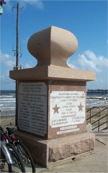
The contractors placed this granite marker on the seawall when they finished their work in 1904.
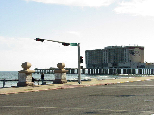
Both granite plaques as the stand today with the Flagship Hotel in the background.
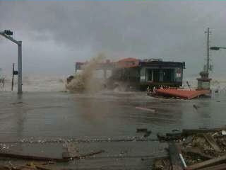
Hooters as it was being destroyed by the storm surge.
You can see one of the granite plaques to the right of it.
 |
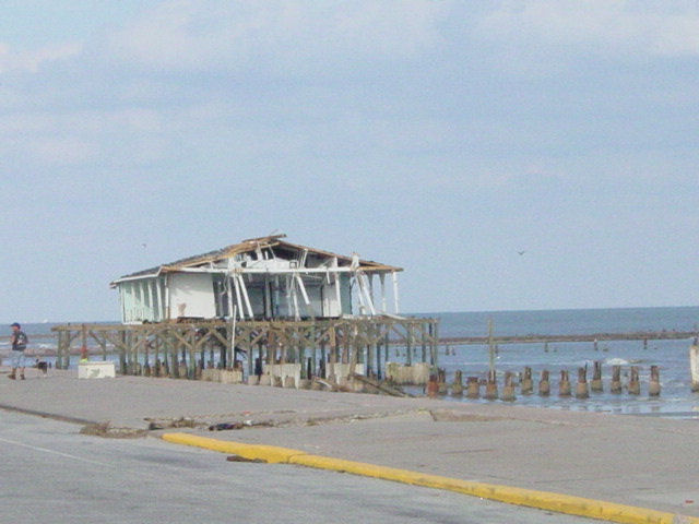 |
What is left of Murdoch's
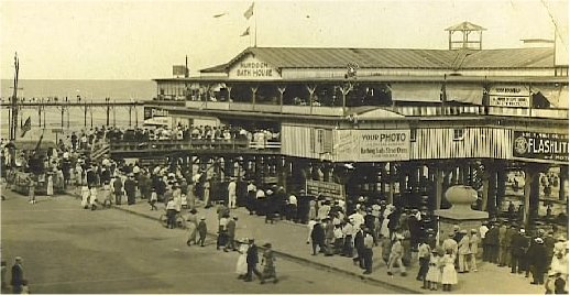
One of the original Murdoch's Bath House with the granite plaque in front.
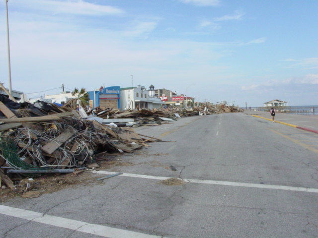 This debris pile is made up of the Balinese Room, Murdoch's and Hooters. What is left of Murdocks is in the background on the right. |
 Another angle of the debris pile showing the Flagship Hotel. |
The Balinese Room which was located to the left of Murdoch's and Hooters was also destroyed completely. Only the pilings are left behind, which was also the case with Hooters.
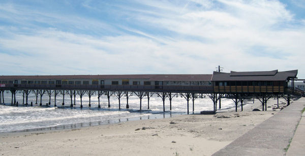
On a nice day
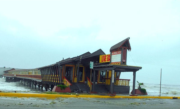
The last hours of the "B" Room
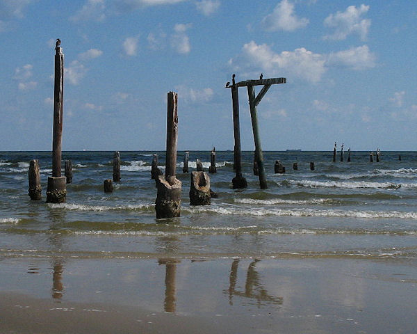
Nothing but broken pilings and dreams.
More on the Balinese Room HERE
 After Ike |
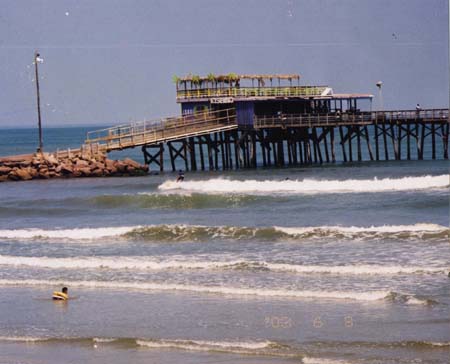
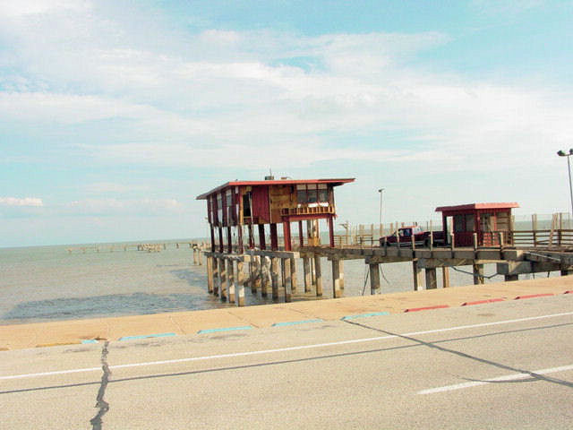
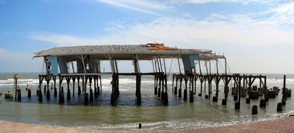
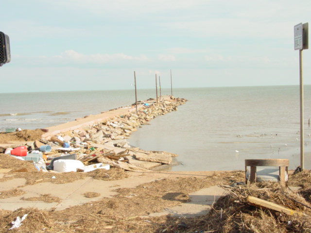
Galveston Fishing Pier located at 91st Street. The owners decided to ride the storm out
on the first floor. Once the st rom got bad, they called for help but was denied due to the
height of the hurricane. They went up to the second floor where they were rescued the
next morning.
 Willie G's Seafood and Steakhouse sits on 21st and Harbor side Dr. Right behind it is the Galveston Channel. |
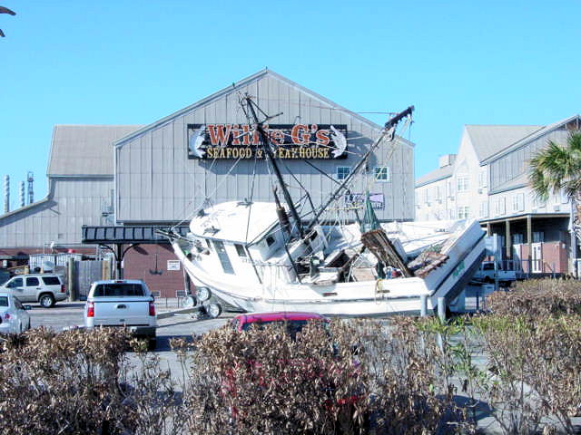 This 4 ton shrimp boat floated in during the storm surge from the channel and now rests in the parking lot. |
Some of these I took, others were donated to me for the Website.
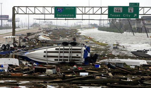
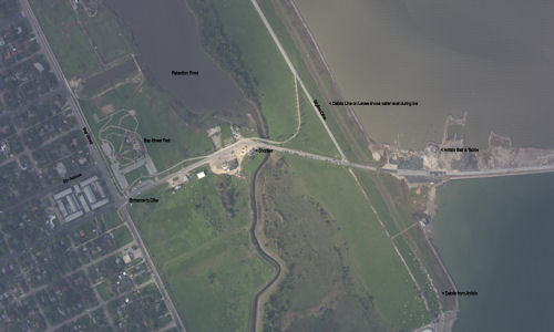
The exit off of HWY 6. To the right is Bayou Vista.
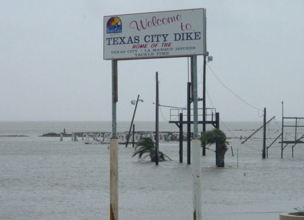 Sign located right over the levee, with the pilings from Anita's Baitcamp. |
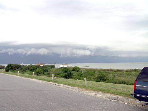
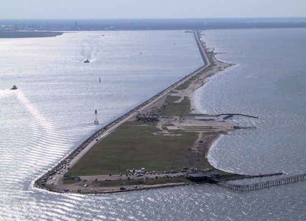 The end of the Dike looking back at Texas City before Ike. |
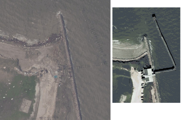
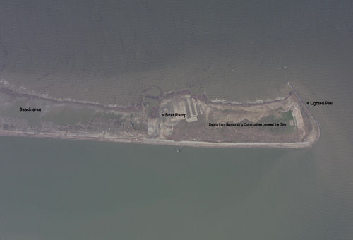
A before and after picture of the Lighted Pier at the end of the Dike.
A great place to watch bands play on Sundays while having burgers and beer.
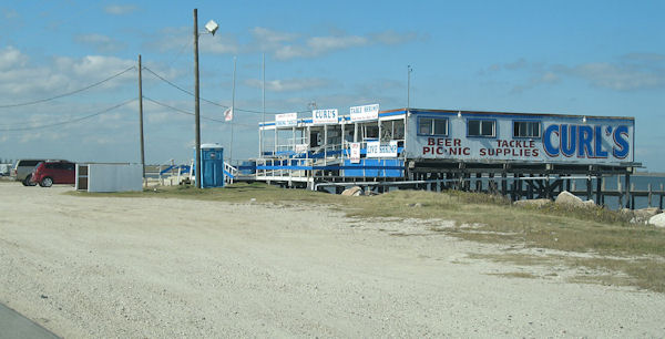
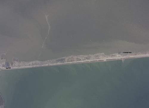
Curls Baitcamp, located about 2 miles down the Dike.
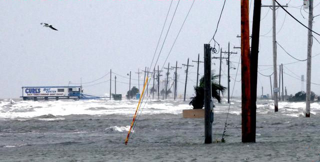
As the water rises over the Dike, during the day well before Ike hit
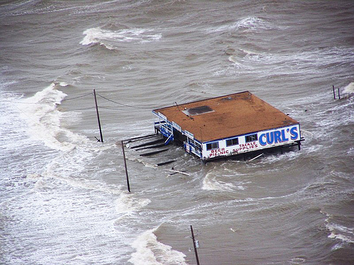 The deck on the from has given away as the water rises. This is during the day on Friday, 10 or so hours before Ike hit. |
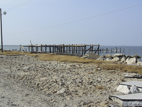 Nothing left but the pilings |
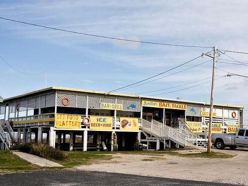
Anita's Bait & Tackle
A great place for burgers and beer. Bands would play there occasionally.
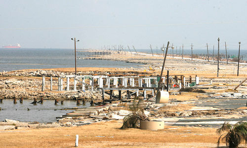
Nothing but pilings now.
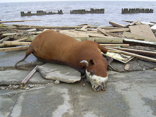 Dead cows littered the Dike |
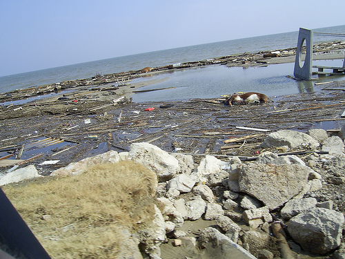 They washed up from Bolivar Peninsula. |
Shorties Ice House which sits on the inside of the Levee at the Dike.
These next pictures are satellite photos after Ike. Click on each picture to bring up a full view of each one.
They are large so let them load and then you can scroll around them. I have added text to them to show landmarks.
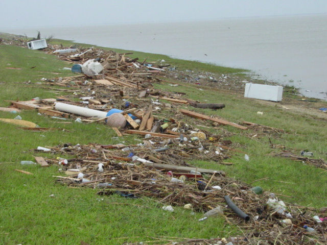
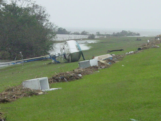
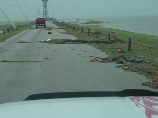
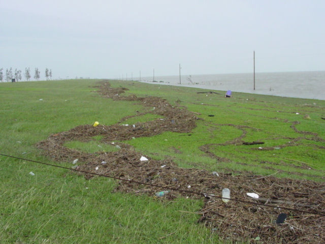 Standing on the Levee looking left from Dike Road. The debris line runs the length of the Levee. |
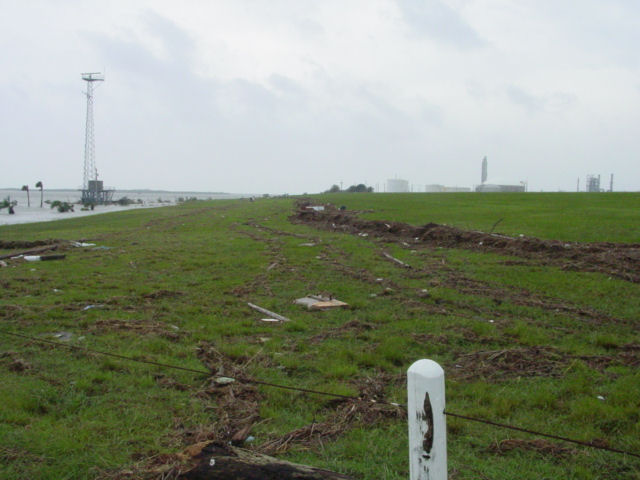 Standing on the Levee looking right from Dike Road. |
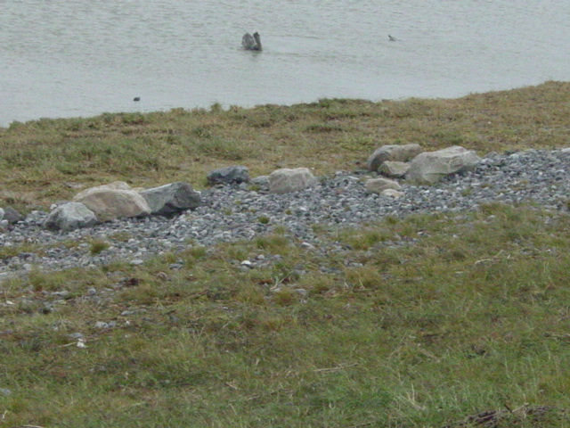
The force of the water washed the rocks up from the base of the Levee up to about the halfway point
 Dollar Bay Baitcamp on the outside of the Levee looks to have survived |
|
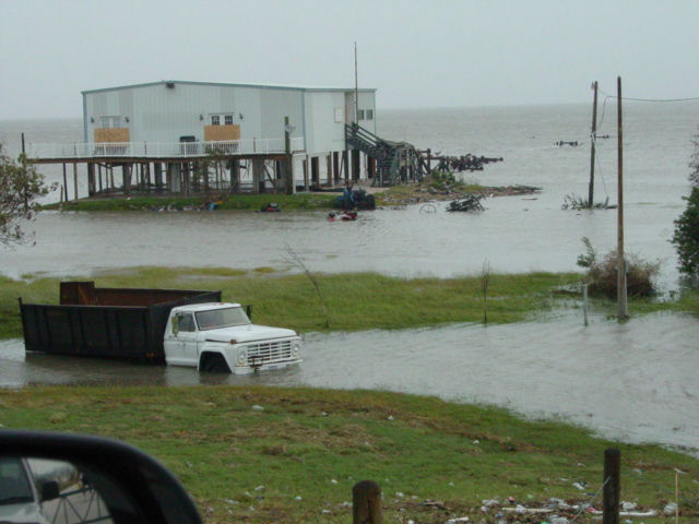
 These two houses sat outside the Levee for years until Ike roared ashore |
 Completely destroyed, this is the furthest house in the picture to the left |
 Looking to the left of the houses, this is what is left of them |
 Looking to the right of them |
 Further down the Levee from the two houses is the Floodgate. You can see where the water was just breaching the Levee. |
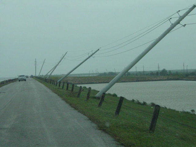 Facing away from the Floodgate, new power pole blown over. |
Click HERE to see how our Levee and Floodgate system works.
It's a large PDF file, so give it time to load.
This page will sow the damage the trees and shrubs took from the storm surge. Might be boring for some but it is fascinating to see all of it in person around the Island.
The saltwater basically pull all the water stored in the trees out of them as water follows salt. A lot of them died but some are slowly recovering.
CLICK HERE!
MORE TO COME SOON
UPDATED
14FEB09